. . . I've been told that I write novels for email messages. Perhaps this is the way to go. I'll try to make each entry, or Gemstone, a "precious" one. On mediocre days, all I might be able to produce is a "semi-precious" entry. In any case, an entry might be a "neat" Gemstone--something that is uniquely mine.

Wednesday, April 9, 2014

Canyonlands National Park: Island in the Sky

Shafer Canyon Overlook
Canyonlands National Park near Moab, UT is divided into different districts. The first district that we visited was Island in the Sky. The whole park is an example of the effects of millions of years of erosion on rock layers deposited nearly 300 million years ago. This area of southeast Utah was flooded by tropical oceans, criscrossed by rivers, covered by mudflats, and buried by desert sand. Layer upon layer of sedimentary rock were deposited.

About 15 million years ago the sea level sedimentary layers were flat. Movements in the earth’s crust caused the whole area to rise; today the average elevation is over 5,000 feet above sea level. This uplifted area is part of the Colorado Plateau and has been eroded from the Colorado and Green Rivers that cut into the plateau and formed the 2,000 feet deep canyons seen today.
Mesa Arch


The Island in the Sky mesa rests on sheer sandstone cliffs over 1,000 feet above the surrounding land. There are pullouts with spectacular views along the scenic drive through the district including overlooks at Shafer Canyon Overlook, Grand View Point, and Buck Canyon Overlook. There are several trails that criss cross the park but we only walked on the shorter ones: Mesa Arch Trail and the Upheaval Dome Overlook Trails, and only hiking 2.5 miles today.


Upheaval Dome Second Overlook

Grand View Point

Tuesday, April 8, 2014

Moab and the Arches

I’ve lived in the southwest for 14 years and finally got the opportunity to visit the area around Moab, Utah. We spent a few days camping in Moab and first visited Arches National Park. Arches has the world’s largest concentration of natural sandstone arches, over 2,000. The park also contains other geologic formations such as sandstone fins, balanced rocks, pinnacles, and spires. Millions of years of deposition, erosion, and other geologic events shaped the layers of rock. 

How Arches Form from Erosion
Arches lies near the heart of a high desert called the Colorado Plateau at an elevation an average of 3,000 feet above sea level with peaks over 12,000 feet above sea level. Roughly 65 million years ago the area was a dry seabed. The red rock formations seen currently in the park were buried beneath the seabed at that time. Geologic forces wrinkled and folded the buried sandstone to form anticlines (kind of like a carpet that has been pushed inward to form lumps across the middle). As the sandstone warped, fractures tore through it.

Skyline Arch
Next, the entire region began to rise, climbing from sea level to thousands of feet in elevation. The forces of erosion carved layer after layer of rock away and exposed deeply buried sandstone layers that expanded and fractured enough to allow water to seep into the rock and further break it down. Water continues to shape the environment through freezing and thawing cycles that break off chunks of sandstone and rain eroding the rock and carrying sediment down washes and canyons. Little by little fractured rock layers turn into fins and then the fins turn into arches.
Broken Arch

Most of the exposed arches are of the Navajo Sandstone, Carmel Formation, and the Entrada Sandstone Slick Rock Member that was laid down during the Triassic period, roughly 150 million years ago. The Carmel layer is a mix of sand and clay and form a rock more dense and less porous than the Entrada Sandstone, which was once a massive desert of fine-grained sand that turned into a very porous sandstone. Underneath these sandstones lie a thick layer of salts that flowed and bulged upward into long domes that forced the sandstones above to crack. As water soaked into the porous Entrada sandstone, it puddled above the more dense Carmel Formation where it eroded the sandstone into a cavity, and in time, an arch.
Tunnel Arch

Turret Arch
There are many types of arches: cliff wall arches such as Park Avenue Arch, Biceps Arch, and Visitor Center Arch; free standing arches such as North Window Arch, Delicate Arch, Landscape Arch, and Double Arch; natural bridges (which required a hike too far to see this time); and pothole arches such as Pothole Arches and Bean Pot Arch.

As we drove the scenic drive through the park, we stopped to hike easy trails to various arches and rock formations. We hiked a total of 7 miles today, enjoying Double Arch, the Windows Arches and Turret Arch, Balanced Rock, Sand Dune Arch, Broken Arch, Skyline Arch, Tunnel Arch, Pine Tree Arch, and lastly, Landscape Arch. There were great overlooks as well including the Firey Furnance, Delicate Arch, Courthouse Towers, and Park Avenue. We stood on the hill overlooking the Moab Fault valley and saw a 40 million year difference between the Entrada Sandstone we were standing on and the Wingate Sandtone exposed across the valley. All in all, a fantastic day--no higher than 70 degrees and sunny with a slight breeze.
Landscape Arch


Saturday, April 5, 2014

Ground Zero: Trinity Site

Ground Zero Monument
Trinity Site is where the first atomic bomb was tested on July 16, 1945. According to the pamphlet given to visitors on the one day a year that they open the site to visitors (first Saturday in April), “The 19-kiloton explosion not only led to a quick end to the war in the Pacific but also ushered the world into the atomic age.”

The story of the Trinity Site begins with the formation of the Manhattan Project in 1942. “The project was given overall responsibility for designing and building an atomic bomb. At the time it was a race to beat the Germans who, according to intelligence reports, were building their own atomic bomb.” Along with sites at Oak Ridge, Tennessee and Hanford, Washington, Los Alamos, New Mexico was established as the place that the bomb was designed and built. Many of the greatest scientific minds of the day studied nuclear theory and labored over the actual construction of the bomb.

Two bombs were designed at Los Alamos: one using uranium 235 and another using plutonium. The uranium bomb was simple enough that scientists did not think it needed testing but the plutonium bomb was more complex and worked by compressing the plutonium to a critical point that would set off a chain reaction that split atoms in the explosion. The test of the plutonium bomb occurred the early morning of July 16th just before dawn at the Trinity Site. The shock wave broke windows 120 miles away and was felt by many at least 160 miles away. There was not much of a crater left, but the desert sand was scooped up into the fireball and melted into a new rock called “Trinitite” that covered the ground.

Trinitite
After visiting Trinity Site, I have come to the conclusion that every New Mexican (and even every American) should visit this historic monument. It is a sobering experience when thinking about the power that was unleashed there 69 years ago--the power that led to such destruction and loss of life that ended World War II.
Mushroom Cloud After 15 Seconds at 10 Miles Away
“The effects could well be called unprecedented, magnificent, beautiful, stupendous, and terrifying. No man-made phenomenon of such tremendous power had ever occurred before. The lighting effects beggared description. The whole country was lighted by a searing light with the intensity many times that of the midday sun.”--Brig. Gen. Thomas Farrell


Wednesday, October 9, 2013

Sending My Oldest to College

So it has been almost 2 months since I dropped my oldest son off at college. I think it has taken this long to discover the "new norm" that is my life with 1/3 of my precious cargo missing from my day-to-day life. Leaving him at college, even though only 3 hours away, was incredibly difficult. I barely made it to the parking lot without being overcome with tears. But the good thing was that two weeks later, Labor Day, he came with us camping and it was just like he never left.

The other 2/3 now each have their own rooms, not having to share anymore, and both are now in double beds instead of their twins. These two are incredibly happy with their new, private spaces. My only concern is that now my oldest does not have a bedroom nor his own private space for when he comes back home for visits and breaks. He will now have to sleep on the sleeper sofa upstairs in the family room. He says he doesn't mind, but in my heart I think he does. I just don't want him to feel that he does not have a home base anymore.

Next home visit will be during a 3-day weekend after midterms in 9 days (but who's counting).

My sister posted an article on her Facebook page, thinking ahead to when her oldest goes to college next year. I'd like to share the link with you and feel so much of what the author feels as he sends his oldest off to college as well: Saying Goodbye to My Child, The Youngster.
The emotions of a parent, I can attest, are an odd mix: part pride, part resignation, part self-pity, even a bit of something that feels like grief.... 
Eighteen years is not enough. A crib is bought. Christmas trees get picked out. There is the park and lullabies and a little help with homework. The days pass uncounted, until they end. The adjustment is traumatic. My son is on the quiet side — observant, thoughtful, a practitioner of companionable silence. I’m learning how empty the quiet can be....
Well, 18 years is a window that closed too quickly. But, my son, those days have been the greatest wonder and privilege of my life. And there will always be a room for you.

Friday, June 7, 2013

Vacationing in Durango and Silverton

We spent a few days vacationing in the Durango, Colorado area this week with family. We stayed up at the Durango Mountain Resort in a vacation rental that fit our family of 12. 
View of a little creek outside our rental balcony
The area is absolutely beautiful, located in the San Juan Mountains with the Animas River running through the valley that was formed by a long mountain glacier. The Durango valley is surrounded by tilting layers of sedimentary rock formed during the Paleozoic and Mesozoic periods (570-65 million years ago), representing episodes of deposition and retreat of ancient seas. Sandstone and shales have a reddish tint to them in places. All this is rested on the granite bedrock (1700 million years ago).
Sedimentary Rocks

We explored Downtown Durango on a couple of different days. Downtown has a lot of cute shops and good restaurants, including Steamworks Brew Pub (try the Lizard Head Red!), Cold Stone Creamery, Durango Coffee Company, Rocky Mountain Chocolate Factory, and notably Ken & Sue’s, where we were spoiled with great food and service when celebrating our parents’ 50th anniversary. We tasted wine at the Four Leaves Winery and enjoyed the Pinot Noir and apple-infused Riesling the most. Lastly, we hopped on the Animas River Walk and enjoyed strolling along the river. We walked about a mile of the seven mile walkway.
Steamworks' Lizard Head Red was delicious!
Strater Hotel, Downtown Durango
Me at the Animas River
We took a day trip to Silverton, an historic mining town full of nice little shops, located at the edge of a volcanic caldera that erupted 27 million years ago. We took a tour of the “Old Hundred Gold Mine” just outside of town in Galena mountain, 1/3 mile in and 3,000 feet underground at an elevation of 12,750 feet and a temperature of about 46 degrees inside. Gold was claimed there at the turn of the century in about 1898 and was mined by various companies until the early 1970’s. Our tour guide explained the hard rock mining process and equipment used throughout the years.
 
Ready to enter the Old Hundred Mine
I'm a hard rock miner! Where's a quartz vein?
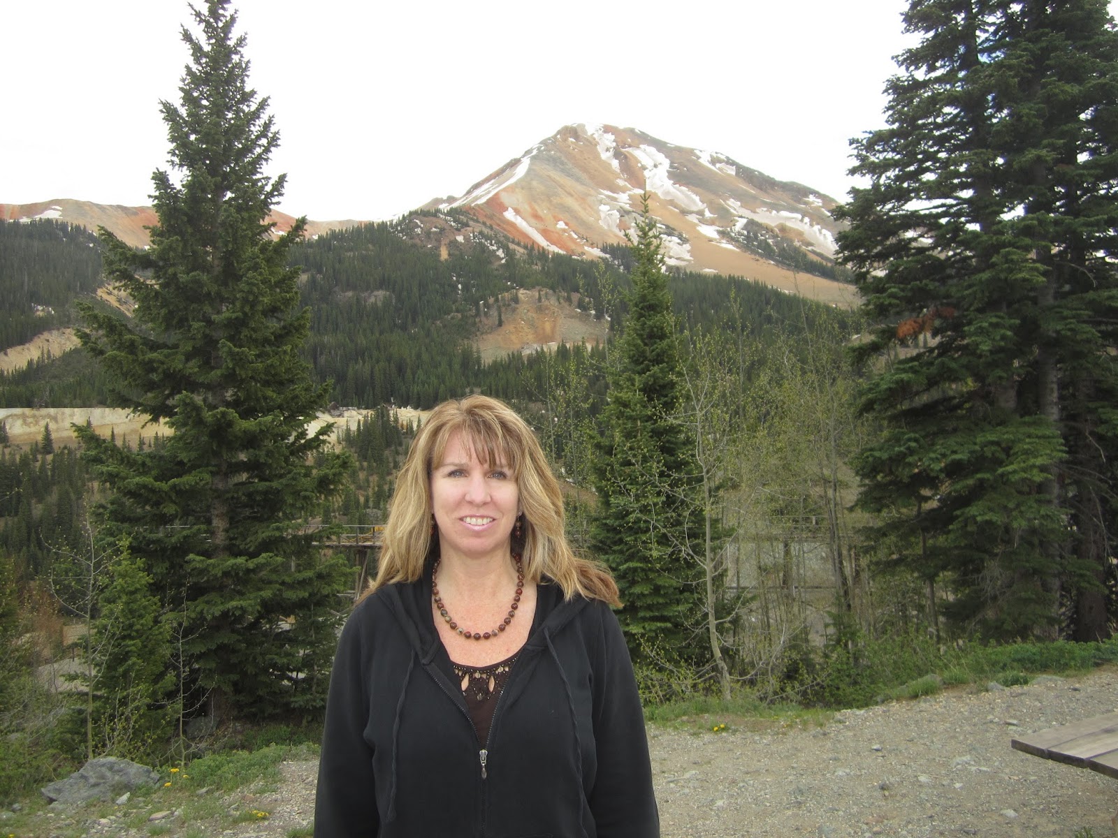
We drove the winding road from Silverton to Ouray and enjoyed the beautiful scenery along the drive, especially the Red Mountains, before driving back to the resort. The Red Mountains are a complex system of volcanic flows that have been altered due to Late Tertiary (approximately 1 million years ago) hydrothermal activity. The iron oxides are shades of red, orange, and yellow against the white and gray clays, and are absolutely beautiful.
Red Mountain #3 
On the way out of town on the drive back home we stopped at Chimney Rock National Monument, a sacred place for the Ancestral Puebloans over 1,000 years ago at the southern edge of the San Juan Mountains. On the 1/3 mile Great Kiva trail we saw an evacuated pit house and great kiva. The ruins are one of the highest elevation Ancestral Puebloan sites and is the northeastern-most Chacoan outlier. (Note: price of admission not worth it unless you do both the self-guided and tour-guided trails).
Chimney Rock

Also on the way home, we stopped at Echo Amphitheater (back in New Mexico), a favorite place to take a break on the drive and see the beautiful, colorful rocks of the box canyon. (See blog post Ghost Ranch for a description of the rocks in this formation.)
Echo Amphiteater

It was a fabulous vacation and we had so much to celebrate. The house is too quiet today now that we're back and everyone has left. I look forward to next year’s vacation with my parents and my nephew's graduation, when we'll be together again.