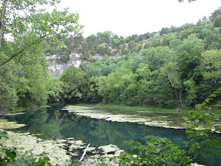
. . . I've been told that I write novels for email messages. Perhaps this is the way to go. I'll try to make each entry, or Gemstone, a "precious" one. On mediocre days, all I might be able to produce is a "semi-precious" entry. In any case, an entry might be a "neat" Gemstone--something that is uniquely mine.

Monday, July 30, 2012

Meet Me in St. Louis

''Meet me in St. Louis, Louis,
Meet me at the Fair
Don't tell me the lights are shining
Anyplace but there
We will dance the 'Hoochie-Koochie'
I will be your 'Tootsie-Wootsie'
If you will meet me in St. Louis, Louis,
Meet me at the Fair.''

- First chorus of the 1904 popular song ''Meet Me in St. Louis,'' celebrating the St. Louis World's Fair of the same year.

Ok. So I don't know what the "hoochie-koochie" was, but I definitely don't want to dance it and become someone's "tootsie-wootsie" but I did want to visit St. Louis, especially the Gateway Arch. We planned an evening flight back home so that we'd have time to get downtown, go up in the Arch, and make it to the airport in time for our flight.


Now for some reason, I thought the Arch was built in time for the World's Fair, which I discovered to be in 1904 and was officially called the 1904 Louisiana Purchase Exposition. Who knew, right? Well thanks to Google, yet again, I found out all kinds of information, the most important is that it wasn't built until 1965. It had originally been planned after the design won an open art competition in 1947 but because of financial backing issues was not built right away. The winners of the design of the Arch were architect Eero Saaurinen and structural engineer Hannskarl Bandel.


View from the north end

I found out that the Arch was all part of an idea to renew an economic downturn by bringing people to the downtown riverfront area of St. Louis. Those old 1947 designs were still in play and somehow the funding was found (with the National Park Service involved this time), and it became part of a whole concept of the "Jefferson National Expansion Memorial" that also holds the Museum of Westward Expansion and the old Jefferson County Court House on the park grounds. According to the National Park Service website linked here:
"The Arch reflects St. Louis' role in the Westward Expansion of the United States during the 19th century. The park is a memorial to Thomas Jefferson's role in opening the west, to the pioneers who helped shape its history, and to Dred Scott who sued for his freedom in the old courthouse."
Which leads me to another question....Who was Dred Scott? (Wikipedia to the rescue!) Two trials of his case, in 1847 and 1850 were held in the old courthouse in which Scott sued in court for the right to be a free man in the state of Missouri. It went to the Supreme Court because nobody could figure out if Scott even had the right to sue, having no rights as a white man does. In the Supreme Court ruling in his case, they determined that people of African descent brought into the U.S. and held as slaves (or their descendants) were not protected by the Constitution and were not U.S. citizens. Scott was considered a free man in other states but when he moved to Missouri he wasn't. His case retains historical significance as one of the worst decisions ever made by the Supreme Court. In fact, some argue that it was this case that began a pathway toward the Civil War. In any case, it was credited with launching Abraham Lincoln's political career and ultimate election.
Looking straight up
The Arch is 630 feet high and 630 feet wide from leg to leg. It is the tallest memorial in the United States and the tallest stainless steel monument in the world. The base of each leg is an equilateral triangle with each side 54 feet long at the bottom and narrowing to 17 feet at the top. (The legs are wider at the bottom).The Arch is hollow to accommodate a tram that takes riders up to an observation deck at the top. It consists of a train of 8 egg-shaped cars that seat 5 people and takes about 4 minutes to get up (3 minutes to get down). They open up to the top observation deck where we were able to look down on St. Louis and the Mississippi River. Absolutely amazing! 
View from the top down to the Old Courthouse
According to poet Calvin Trillin from Kansas City, Missouri, when being compared to poet T.S. Eliot, a St. Louis native:
"Some have questioned whether St. Louis really was the Gateway to the West....I'm from Kansas City where people think of St. Louis not as the Gateway to the West but as the Exit from the East."

That's another way of looking at it I guess. In any case, I can check the Gateway Arch off of my Bucket List now!
Me with the arch in the background

Saturday, July 28, 2012

The Largest Cave in the Lakes Area

After a day out in the sun and heat and on the water (we rented a pontoon boat and tube for the afternoon yesterday), we decided to stay out of it all and explore Jacob's Cave in Versailles. Jacob's Cave is the largest cave in the Lake of the Ozarks area, 1/2 mile long, 70 feet down, and completely accessible for people with disabilities and baby strollers. It was the first commercialized cave in the area, opening in 1932 to tourists. At that time, people walked on wooden planks and used kerosene lanterns to explore.

A beautiful "room" at the end of the 1/2 mile trail
According to the Jacob's Cave home page (linked above):
"Jacob's Cave is famous for its depth illusion, reflective pools, ceiling sponge work, prehistoric bones (mastodon), bear, and peccary), and the world's largest geode. On the mile-long tour you will see every type of cave formation imaginable, from millions of "soda straws" and massive stalactites and columns, to delicate helictites. Evidence of six ice ages and three earthquakes can be seen in the cave. The temperature remains a constant 53 degrees inside the cave."
Cave "pearls" which actually do form around a tiny bit of sand
If you are interested in the cave formation and geology, visit this link: Jacob's Cave Geology. Of course I found it totally interesting and was glad to have something to read about the cave--much more impressed than information NOT available from the first cave we visited. Basically, the rock the cave was formed in is from the Silurian period 430 million years ago. The Silurian Sea was full of coral reefs and marine wildlife which created the dolomite rock that the cave was dissolved into. About 45 million years ago the area uplifted, forming the caves in the Ozark Plateau. Three earthquakes occurred in the area at 45 and 17 million years ago with the most recent being the New Madrid event in 1811-1812 at 8.1-8.3 magnitude on the Richter Scale. This event is written in every geology text because it is highly unusual to have such large earthquakes in the middle of a continent. The New Madrid earthquake was so strong that it forced the Mississippi River to run backwards for 6 days before changing its course when it started flowing toward the ocean again.
A column that has been fractured by the New Madrid earthquake
Jacob's cave was discovered by Jacob Craycraft, a miner in 1875. He may have gotten a map to the cave drawn by Spainards and found in the local library by Jacob. As Jacob was prospecting for new minerals he came across an animal hole along a fracture line and began digging, exposing a larger entrance that led him through the same 1/2 mile that makes up the cave tour. He autographed a stalactite with lead pencil, which still can be seen in the calcite. The cave has been known by man for 120 years and available to the public for 45 years. Click here for more History facts about Jacob's Cave.
Many soda straws decorated the cave ceiling

Thursday, July 26, 2012

Land of the Laughing Water


Today’s adventure started early this morning. I got everyone up early so that we could beat the heat and go explore some trails and ruins at Ha Ha Tonka State Park, named for the Native American words for “land of the laughing water”. It was extra good that it was overcast today so when we left the hotel at 8 am it was 80 degrees. What a welcome relief!
What drew me to the Ha Ha Tonka State Park was the descriptions I read about on the state parks and in the vacation guide. Geologically, Ha Ha Tonka is classified as having “karst” topography, meaning the landscape is characterized by sinkholes, caves, underground streams, springs, and natural bridges. I had to see this in person, this geological wonderland, having only read about this kind of landscape and seeing examples in my geology textbooks. 
View from 250 feet up of Lake of the Ozarks
Caves and springs are formed primarily in the limestones and dolomites that make up most of this bedrock in these Ozarks. At the earth’s surface, rainwater combines with the carbon dioxide given off by decaying vegetation and forms a weak carbonic acid solution that moves down through joints, crevices, or fractures in the rock, dissolving it. The dissolved openings are the caves and spring conduits that make up the karst topography. We saw a huge (70 feet wide and 100 feet high) natural bridge/arch (depending on if you walk over the top or through the bottom) with a layer of 550 million-year-old dolomite covered in sandstone, and what is boasted to be Missouri’s 12th largest spring. We walked into the Colosseum sinkhole which is 500 by 300 feet, created when a huge cavern collapsed.
The natural bridge/arch
Something else about Ha Ha Tonka that I thought would be interesting to see is the ruins of a burt-out stone shell of a “castle” built by a wealthy Kansas City businessman/grocer, Robert M. Snyder and his family, at the turn of the century. The mansion ruins sit on a 250-foot bluff and overlooks the Ha Ha Tonka Spring and the Lake of the Ozarks. Construction began in 1905 that included the mansion, carriage house, 80-foot water tower, and a greenhouse. Unfortunately a year later Snyder was killed in one of the state’s first automobile accidents. Snyder’s sons finished building it but in 1942 the entire interior was gutted by fire when sparks from a chimney ignited the mansion and carriage house’s roofs. Then in 1976 the water tower was burned by vandals. So all that remains today of the businessman’s dream are ruins.
The front side of the mansion
The spring, a constant 56 degrees
Of course, at Ha Ha Tonka, I also wanted to see the lush landscape that once concealed moonshiners and counterfeiters in the hills! We didn’t get to visit them, but there were two caves used as hideouts by criminals in the 1830s, Counterfeiter’s Cave and Robber’s Cave.

This afternoon's plan? Spiderman!

Wednesday, July 25, 2012

Ozark Caverns, a Winery, and a Little Dinner Cruise

What do two geologists do while in the Cave State? Visit as many caves as possible while they're there, of course!

Today we explored Ozark Caverns at the Lake of the Ozarks State Park. Unfortunately, we could not take cameras into the caverns because the park is guarding against "white-nose syndrome", a fungus that has devastated bats throughout the northeastern caves. This white-nose syndrome was first discovered in Missouri so to minimize the risk, they are really being strict. So I took pictures of the museum display boards.

Ozark Caverns entrance
According to a brochure (yay, a brochure!) found in our hotel lobby,
"a walk through Ozark Caverns is a journey into an environment where geologic process can proceed unhindered by many of the erratic, erosive forces that shape the surface landscape in the protected cave environment; dripping and seeping water can redeposit carbonate materials in the form of soda straws, helictites, stalagmites, and a host of other geologic wonders that can be seen in Ozark Caverns. 
Angel Showers, an unusual cave phenomenon, is a featured part of the Ozark Caverns tour. The never-ending shower of water seems to come out of the solid ceiling of rock."
Photo of Angel's Shower from the museum wall. There are only 4 showers like this in the U.S.
Something truly cool was seeing bear claw marks left in the sediment fill that came into the cave thousands of years ago. (I'll just mention that we read of many small critters that inhabit the cave from frogs, salamanders, bats, and little bitty invertebrates in the little museum). Middle son did count 11 bats while we were in the cave. Creepy little critters. We were told that the cave was about 300 feet below the surface and we walked about 1/4 mile in (1,400 of the 3,400 feet of passageway). We used lantern light to walk through the cavern instead of the traditional "lighted path" method--truly cool, but oldest son was disappointed that the cave features were not lit up.

And what do two geologists do after "doing" geology? Seek out the local winery for tasting, of course! We found one just down the road from the Caverns called Seven Springs Winery, which boasts of having 160 acres of vineyards. We tasted some Missouri wines and found them quite tasty. It was interesting to learn of grape varieties that I've never heard of before such as "Norton," "Vignoles," and "Rougon." They used a blend of grapes for their wines rather than a pure grape wine like "Pinot Grigio," "Chardonnay," or "Merlot." that I'm used to. The blends tended to be toward the sweeter end of the spectrum, which was really good. We got a couple of wines to take back to the hotel with us.

A large tasting menu with pretty wine glasses at Seven Springs
We spent the afternoon at the lake swimming for a bit before heading out to the Bagnell Dam strip and our dinner cruise on the Tom Sawyer Paddleboat. The food was good, being "picnic" fare with fried chicken, ribs, ranch beans, potatoes au gratin, cole slaw, and rolls. My youngest had 3 pieces of chicken himself. If only it weren't so darn hot, then it would have been a perfect cruise. I think it was still 100 degrees when we left the dock at 6:30 this evening. Sweat rolled down our faces and backs until we got into the air conditioned car!

The paddlewheel at the back of the Tom Sawyer
Thankfully, nobody complained about following our lead today. I get to be "Tour Guide Barbie" or "Cruise Director Julie" when we go on trips together and I take my job seriously! Tonight's plan? Stay in the cool air conditioned hotel room!


Tuesday, July 24, 2012

Bridal Cave

Today we went to visit Bridal Cave in Camdenton, Missouri, about a half hour south of where we're staying here in Osage Beach. Of course we left early in the morning so that we could try to beat the heat of the day with being out and about and not in the water like we were yesterday. Yesterday we spent hours at the lake, then ate lunch, then spent more time at the pool, then middle son and I went to the lake again. It was the relaxing day we intended for our first day here. But today a little bit of exploring!

The Bridal "Veil" in the Chapel
Bridal Cave was discovered by the Osage Indians centuries ago. It lies beneath Thunder Mountain and is said to be the site of the legendary Native American ceremony in the early 1800's. In keeping with the tradition of the Native American Legend (which I will include below), the cave can be reserved for a romantic wedding chapel. Of course, it costs money to do so. If we had such money we'd have arranged for my in-laws to renew their 50-year-old wedding vows.

Here is the Legend of Bridal Cave:

Centuries before the paleface found his way into the Ozark Mountains, this vicinity was inhabited by the Osage Indians.  Within the Osage tribe many smaller tribes were formed.  The following incident is a legend which brought romance and tragedy to this section of the Ozarks and gave the names to many places as they are known today.
Conwee, son of Chief Neongo of the Big Hills (a tribe of the Osage group, which lived on the north shore of what is now known as Ha Ha Tonka State Park), fell in love with Wasena, daughter of Elkhorn, Chief of the Little Hills, who lived on the north side of the Osage River near the junction of the Niangua, and greatly desired that she become his wife.  Neither Wasena nor her father looked with favor on his intentions, Conwee however was not to be discouraged.  He left his camp at Ha Ha Tonka one dark night with a number of his braves, crossed the Osage River near the junction of the Niangua and kidnapped Wasena and her companion, Irona.  Hastily, recrossing the Osage River, Conwee started back to Ha Ha Tonka.  As dawn approached and threatened to reveal them to their pursuers, they decided to stop at the cave, now known as Bridal Cave, and conceal their captives.  After a short time in the cave, Wasena eluded her captors and ran swiftly toward a high cliff that towers two hundred feet above the Niangua River.   When Conwee had her almost within his grasp. she reached the edge of the cliff and without even a backward glance sprang over the the brink into the valley below, choosing death rather than life with one she did not love.  From that day forward this cliff has been known as "Lover's Leap".
The fate of Wasena's companion, Irona, was very different.  She had long loved Prince Buffalo, another son of Chief Neongo of the Big Hills Tribe, and brother of Conwee.  After a period of mourning over the death of Wasena was ended, Irona and her Prince Buffalo chose to be married in the cave where she and Wasena had been held captive in the beautiful stalactite - studded room now known as the Bridal Chapel, and gave the name "Bridal Cave" to the scene of the nuptials. from "Indian Romances" by Col. R.G. Scott
Now, I give you this story here because I learned it from the Bridal Cave website. If I  hadn't visited the website, none of us would know the story behind the name. When listening to the tour guide, she said nothing about the Native American legend. She also said nothing about the geology of the cave nor the names of the cave features we saw. She never described what we saw: draperies, soda straws, stalactites, stalagmites....she did, however, mention that the water dripping down in the cave takes seven years to reach the formations from the surface and that the cave is 250 feet below Thunder Mountain. Another thing I could not believe was that there were no pamphlets of any kind describing the geology, history, formations, or anything. I asked. I guess they don't read pamphlets in Missouri.

The RockWall
But, aside from my complaints including hearing the guide mispronounce the mineral name manganese and the rock shop misidentifying a rock that was obviously a schist as adventurine the mineral (the mineral was in the schist but only as inclusions), the cave itself was quite beautiful. There were a number of "rooms" with fantastic draperies and columns and at the end of the trail there was the gorgeous Mystery Lake, which the guide claimed to be 35 feet deep. At the bottom of the lake were some timbers and a ladder that nobody knows how or when it got there.

So yes, visit Bridal Cave, but do some research before you go and learn about cave geology and formations so you'll know what you're seeing when you tour.

Sunday, July 22, 2012

Ozark Mountain Daredevils

Many years ago when I was young, I used to listen to all kinds of great music with my dad. Today I think of the band, “The Ozark Mountain Daredevils”. Anyone heard of them? I honestly cannot think of a song that they sang at this time (although my dad could probably hum a chorus and I’d remember immediately). What made me think of this 1970’s band (yes, I’m dating myself) is that my family of five plus my in-laws are off to become Ozark Mountain Daredevils ourselves. We’re off to Misery! Er, Ah, I mean Missouri (having to correct my 11-year-old on the pronunciation of the state we’re about to visit). We’re going to beat the heat and humidity with fun and adventure in the great Cave State, also known as the Show-Me state, entered into the union on August 10, 1821 as the 24th state. Home to such personalities as Walt Disney, Yogi Berra, T.S. Eliot, and Harry S. Truman (not to forget Mark Twain, of course).


Now when I found out that Missouri was our vacation destination about 6 months ago, I was not too sure I’d have a good time. After all, I only heard of negative things like heat, humidity, and lots of bugs, including those bugs that I have only heard of but have never seen before: chiggers and noseeums. (I made it worse by Googling “chiggers” and got even more freaked out from the photos and descriptions of the biting little freaks). But now, armed with bug spray, sunscreen, and a map to multiple cool dark caves, I’m ready to go! I should note here that it is only due to my in-law’s generosity that we are able to stay at their Time Share for free for the week. Did I mention that we’re staying smack dab in the middle of the state, about 3 hours west of St. Louis? No? Well we are going to be staying at Lake of the Ozarks, a many-fingered, 90-mile manmade lake that was made when engineers dammed up the Osage River in 1931. The Bagnell Dam is a 148 feet high concrete gravity dam and was built to generate hydroelectric power.
The Lake of the Ozarks is divided up into 4 regions
So Google and I became fast friends, yet again, as I typed in search words: “Lake of the Ozarks” and up popped a multitude of websites. The most informative was funlakevacationguide.com which provided a pdf of this summer’s vacation guide to download--a plethora of information, places to go, things to do, caves to explore.... I learned that the Lake of the Ozarks is at the edge of the Ozark Plateau that extends from southern Missouri and northern Arkansas (yes, Google helped me locate this forgotten state--it’s right below Missouri) and is nestled between the Missouri and Arkansas (just passed it here in the car!) rivers. The lake has more than 1,000 miles of meandering shoreline and based on a map, it reminds me of a fancy calligraphy-like “S”. I also learned that it is a perfect premier vacation spot for water skiers, speed boaters, jet-skiers, fishing, swimming, parasailing, and pretty much any other water sport that you can think up. Too bad we don’t participate in any water sports, coming from the dry state of New Mexico. “I only dog paddle” is the phrase that comes to mind, spoken from the eloquent Fezzik from one of my favorite movies of all time,  The Princess Bride.

One thing about Missouri really caught my attention when doing my research. I immediately perked up when I heard that one of it’s nicknames was “the Cave State”. Yes! It earns its name with more than 5,000 registered and mapped wild caves. For our family plus in-laws, there are three possible “developed” caves that we can tour: Jacob’s Cave, Bridal Cave, or the Ozark Caverns at Lake of the Ozarks State Park. This part of Missouri, the Ozark Plateau, is known for its karst topography, a geologic feature which is marked by subterranean system of caves, springs, fissures, and sinkholes within the limestone and dolomite rock of the plateau that originated in the Paleozoic seas of the Ordovician period 450 million years ago. I hope to be able to explore the many trails that wind in and out of the landscape at the state park mentioned above. And to top off our trip we plan to go visit the Gateway Arch in downtown St. Louis on our last day here.True Ozark Mountain Daredevils, if I do say so myself!