. . . I've been told that I write novels for email messages. Perhaps this is the way to go. I'll try to make each entry, or Gemstone, a "precious" one. On mediocre days, all I might be able to produce is a "semi-precious" entry. In any case, an entry might be a "neat" Gemstone--something that is uniquely mine.

Sunday, July 18, 2010

A Dream Like I've Never Had Before

Last night's dream was truly odd. I was on some sort of cruise ship, not alone, and we were searching for a place to eat. We ended up at one of those dinner shows and before I knew it, I was up on the stage singing! For one, I don't sing very well, and two, I'd never do it on a stage in front of an audience. I definitely have a fear of giving speeches and singing would be 10 times as scary! But there I was. I don't know what the song was, either. That would have been good to know.

So I looked up what singing in a dream meant on dreammoods.com and read the following: "To sing in your dream, represents happiness, harmony and joy in some situation or relationship. You are uplifting others with your positive attitude and cheerful disposition. Singing is a way to celebrate, communicate, embrace, and express your feelings."

Doesn't that sound good? I like it. Maybe I'm happy because I just had a wonderful vacation. Or maybe I am happy in the relationship with the person that I was with in the dream. In any case, I like to think that I've got a positive attitude and cheerful disposition. But if there's a way to communicate that in any other way besides getting up in front of an audience and singing, I'm all for that instead!

Saturday, July 17, 2010

Petrified Forest National Park

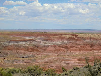
We took a detour off of I-40 as we headed east toward home yesterday and drove through Petrified Forest National Park and the Painted Desert. I've always driven straight through this stretch of Arizona but this time thought it'd be great to stop. Unfortunately, it was 100° outside so we didn't walk any long trails, preferring to drive to lookout points, getting out for pictures, and hurrying back into the air conditioned truck. Still, it was worth the extra time to go through.

Currently this portion of Arizona is a dry grasslands but about 200 million years ago during the late Triassic period it was a humid, tropical, vast floodplain that had many streams crossing it. Tall conifer trees grew along the banks would fall and the streams would wash them into the floodplains. A mix of silt, mud, and volcanic ash buried the logs. The sediment cut off oxygen and slowed the logs' decay. Over time silica-rich groundwater seeped through the logs, replacing the original wood tissues with silica deposits. Eventually the silica crystallized into quartz and the logs were preserved as petrified wood.

At the southern end of Petrified Forest National Park is a short Giant Logs Trail. Normally they say the 0.3 mile loop should take 20 minutes but I think we did it in 10 because of the heat. Still, we saw wonderful, colorful petrified wood deposits in the Chinle Formation. The colors of the logs are due to trace minerals that soaked into the wood along with the silica. Blue, purple, brown and black are caused by manganese minerals.

As you drive north along the park road you are driving toward younger deposits. At the farthest north, at Chinde Point on the Painted Desert portion of the park, the rocks are about 205 million years old. Over 10 million years of deposition occurred within the park. The views of the Painted Desert were remarkable. Next time I'd like to visit during the spring or fall when it isn't so hot!

Thursday, July 15, 2010

Sunset Crater Volcano National Monument

The third national monument we visited on Wednesday was located about 20 miles north of Flagstaff: the Sunset Crater Volcano National Monument. It is located within the San Francisco Volcanic Field on the Colorado Plateau that was active beginning six million years ago. Sunset Crater is the most recent eruption, exploding between 1040 and 1100. The Sinagua lived and farmed the area and so were witnesses to this eruption.

Sunset Crater is a cinder cone, forming when molten rock sprayed high into the air from a crack in the ground. The lava solidified and fell to Earth as large bombs or small cinders. Eruption after eruption occurred in this manner, building a debris pile up to 1,000 feet high. Two lava flows erupted near the vent, the Kana-a and the Bonito, and destroyed everything in their path. The entire event may have lasted 6 months to a year with a final eruption spewing red and yellow cinders out from the vent and onto the rim. The colorful glow from these cinders reminded people of a sunset and led to the volcano's name. The elevation at the summit is 8,029 feet with it's diameter at its base 1 mile. Approximately one billion tons of material was extruded from the vent.

We walked along a trail over the Bonito lava flow to the base of Sunset Crater. The gravel beneath our feet was black and the rocks a chunky, clinky form of lava called "aa." It is the same kind of lava flow that I walked over when on the big island of Hawaii. The rock is also known as "basalt."

The ancestors of today's Hopi people, the Sinagua, witnessed the eruption. In some Hopi accounts, the Qa'na Katsina caused Sunset Crater to erupt after people engaged in a life out of balance. The eruption is a living reminder that if people stray from their religious ideals and life, there may be another eruption.


Walnut Canyon National Monument

After we visited Meteor Crater yesterday, we went to Walnut Canyon National Monument near Flagstaff. At first all I saw as I walked the 270 steps down to the Island Trail from the visitor center were the rock layers. I noticed right away the cross bedding within the CoconinoSandstone (left) and the blocky pattern of the Kaibab Limestone that was above it. After looking more, I noticed ancient dwellings of the Sinagua built into one layer of the overhanging limestone cliffs.

In the canyon you see the layering of the Kaibab Limestone on top of the Coconino Sandstone but what you don't see right away is a limey shale layer under the limestone. Because shale is less resistant to weathering and erosion, it was carved away by flowing water, leaving the limestone overhang above it. The Sinagua built walls and fronts using the overhangs as roofs. They used blocks of limestone cemented with clay. The dwellings go back at least 10 feet and are on average 5 feet high.

The Sinagua lived in the canyon from 1125 to 1250 when the canyon was fertile. It is not clear why the people left but they moved to new villages and were eventually assimilated into the Hopi culture.

Meteor Crater

Yesterday (Wednesday) we visited another big hole in the ground, this one not formed from earth’s natural processes, but from something extraterrestrial.

Meteor crater was formed 50,000 years ago when an iron-nickel meteorite (meteors stay in the sky, meteorites hit the ground) struck what is now the Arizona desert. The meteor is estimated to have been about 150 feet across and weighed several hundred thousand tons (a 2-foot wide, 1,400-pound fragment of it is pictured, above left). It struck the land with an explosive force greater than 20 million tons of TNT. During the crater’s formation, over 175 million tons of rock were thrown out a distance of over a mile. Large blocks of limestone, the size of small houses, were heaved onto the rim and flat-lying beds of rock were overturned or uplifted as much as 150 feet.

The crater made a hole in the rocks of the Kaibab Limestone and Coconino Sandstone from 260 million years ago. The crater is over 4,000 feet across and 550 feet deep. Originally, the crater is thought to have been 700 feet deep (as tall as a 70-story building) but erosion has transferred the topsoil over time. The circumference is 2.4 miles.

How do scientists know that the crater isn’t a volcanic caldera? After all, people argued over its origin when it was first discovered in 1871. Local settlers just thought it was part of the Hopi Buttes volcanic field northeast of the site. After many years of study, scientists have concluded that it is definitely not volcanic and that it is the result of an impact. There is the presence of many meteorite fragments on the northeast side of the crater. Plus, two minerals: coesite and stishovite were present in the rocks, both high-pressure forms of quartz that were altered by the extremely high pressure of the impact. These minerals are not found in volcanic craters or rocks.

During 1964 through 1972, the US Geological Survey and NASA provided science and sampling training for the Apollo astronauts because scientists were interested in what kind of materials might lay on the moon’s surface and below.

Collisions have occurred since the beginning of the solar system and will continue to occur. Collisions the size of the one that hit Meteor Crater average every 50,000 years. It’s time for another one so luckily scientists are “looking” to the skies with their high-powered digital telescopes.

Some information came from what I learned from the museum displays and from a pamphlet handed out at the fee station called, “Meteor Crater: Brief History.”

Wednesday, July 14, 2010

The Grand Canyon in One Day

The Grand Canyon: "the place every American should see." — President Theodore Roosevelt

Yesterday we spent the whole day at the south rim of Grand Canyon National Park. As I mentioned in a previous blog entry, the last time I was at the Grand Canyon was 15 years ago but that time we only explored the east side of the south rim. I don’t remember whether we explored the west side of the south rim or not when I came here when I was 9, but in any case, we went al the way west to Hermit’s Rest and all the way east to Desert View this visit. We walked the rim trail as often as we could and took the shuttle bus when we didn’t.

Information on the Grand Canyon is all over the Internet and in many publications already so I won’t give an in-depth geologic history lesson here—just some basic facts.

The Grand Canyon cuts down into the Colorado Plateau that stretches north to Utah, northeast to Colorado, and east to New Mexico. At the south rim, the elevation is 7,000 feet. The Canyon spans almost 2 billion years of time from the basement rocks of the Vishnu Schist to the 270 million year old Kaibab Limestone at the top. Below the Kaibab Limestone is the same Coconino Sandstone and Hermit Shale exposed in the Sedona rocks.

According to the National Park Service pamphlet that is handed out at the entrance, “The Grand Canyon reveals a beautiful sequence of rock layers that serve as windows into time.” The Canyon was carved by the Colorado River 5 or 6 million years ago and is now about a mile deep. Its width varies from 8 miles to 18 miles wide and extends about 280 river miles long. As the river cuts down, the canyon deepens. Tributaries erode into the canyon’s sides and increase its width. Erosion carves faster into the softer rock layers like the shales and undermine the harder layers like the sandstones, creating cliffs, slopes, buttes, and pinnacles.

The views along the rim are inspiring and beautiful. Looking across the Canyon gives you such a feeling of power and beauty at the same time. What nature can create, with the dazzing erosional forms, rock colors, and geologic time is just awesome. Truly a place that every American, every person, should see.

Monday, July 12, 2010

Cathedral Rock

This afternoon we drove out to Red Rock Crossing, accessible from a beautiful park called "Crescent Moon Ranch" along Oak Creek that has spectacular views of Cathedral Rock. I took some pictures with the sun shining on the rock formation before getting to the park but once we got to the park the sun went behind the clouds again. Nevertheless, I got some really beautiful pictures. I'd love to spend more time at the park wandering the trails.


The Verde Valley and Back to Sedona

This morning's adventure took us south of Sedona to the Verde Valley near the intersections of Hwy 179 and I-17. We explored Montezuma Castle National Monument and Montezuma Well. The area is within a fault zone and was once a freshwater lake 12 million years ago, forming a white limestone from the sediment. Scientists believe that faulting caused the lava dam holding in the water to fracture and the lake to drain 2 million years ago.

In a cave in the Verde Limestone, the Sinagua peoples built what is now called Montezuma Castle around 1150 CE. The structure is a 5-story, 20-room dwelling standing 100 feet above the valley. Early settlers believed the structure was Aztec in origin and named it "Montezuma" after the great Aztec emperor. The name has stuck. The Sinagua built this dwelling above Beaver Creek, which is now dry. Perhaps that was why the pueblo people left the area.

Eleven miles northeast of the castle is Montezuma Well, a limestone sink hole that formed by the collapse of an immense underground cavern about 11,000 years ago. There are still
springs that feed it so it remains full of water (a constant 76°) and there are species that live there that are not found anywhere else.

The Sinagua irrigated crops with the sink's water and built irrigation ditches to help them. There are cliff and cave dwellings and pueblo ruins to see along the trail. Stairs take you down 150 feet to the shoreline where there is a shady area with ruins. Another set of stairs down the trail takes you to a natural oasis where the 1,000-year-old irrigation ditch still flows today.

On the way back to Sedona, we stopped for two quick picture opportunities: Bell Rock and another view of Cathedral Rock. Since it was 93° outside, we didn't stay at either place very long, preferring to get back to the timeshare and the air conditioning and pool.

Tomorrow's Adventure: The Grand Canyon!!!

P.S. Bell Rock was another vortex location....nada!

Sunday, July 11, 2010

Red Rock State Park

This morning we went to Red Rock State Park to hike. The park is a nature preserve and environmental education center that has trails winding throughout it. We took a 2 mile loop trail called "Eagle's Nest Trail" that took us along Oak Creek, up about 200 feet to an overlook, and back down. Although we started off among the riparian vegetation, enjoying the coolness of the shade, we quickly heated up as we climbed up out of the creek floor.

Along the creek were willows, cottonwoods, and sycamores, and we saw some blackberry bushes with fruit not quite ripe yet. A couple of striped lizards skittered away from us as we passed them and we heard cicadas as we walked. Once we climbed up out of the forest, we encountered chapparal (it's that stinky stuff Youngest Son doesn't like), shrub oaks, pinon, juniper, and prickly pears.

We were walking in the Hermit Formation, older than the Schnebly Hill Formation from yesterday's hike. The Hermit Formation is a siltstone formed on an ocean floor some 280 million years ago. Hematite (iron oxide) colors the rock red here too.

At the top of the hill was a great overlook. We could see the greater Sedona area with Cathedral Rock in the distance (photo, right). We didn't stay too long at the top because of the heat and were glad to walk downhill back to the visitor's center where we got drinks and candy to reward us for our efforts. Next hike had better be in the cool forest or must begin at 8 am!

Saturday, July 10, 2010

Fay Canyon Trail & Cathedral Rock, Sedona

This morning we went on our first hike in the Red Rock Country. We headed to the "Red Rock Secret Mountain Wilderness" area in the northwest area of Sedona. We orginally were headed to the "Vultee Arch" Trail but the 4x4 road leading to it was 4 miles long and extremely rocky and bumpy so we turned around after only 1 mile. Instead, we went up the paved Dry Creek Road a bit farther and found another trailhead called "Fay Canyon." It was rated as "easy" in the FalconGuides book, "Best Easy Day Hikes: Sedona."

The trail was beautiful, an easy walk through the pinon (spelled pinyon in AZ), cypress, manzanita, and juniper forest. Many flowers were along the trail but of course I didn't know what kind they were. Some of them were the same as what I see at home like the red penstemon (yes, I do know what those are called!). There were century plants (agave) and yucca plants too. We did see a lizard along the trail too.

Along the trail was supposed to be a side route that led to a natural rock arch. We attempted to find the arch but never could. I think we took the wrong side route and didn't want to scramble along the cliffs anymore so just went back to the main trail. Plus, Middle Son was REALLY done with the scrambling so we gave up.

The canyon was amazing with the vertical sandstone cliffs of the Schnebly Hill Formation rising on each side of us. The 270 million-year-old intertidal/beach formation contained a dune deposit and you can see the cross bedding within the layers at the top. The red bedded sandstone was amazing to see.

Now at the end of the trail is a dinosaur head-shaped rock. The end of the trail is also near a vortex location (one canyon over from us). As mentioned in a previous blog, there are four vortexes in the Sedona area. Here in Fay Canyon, we enjoyed the experience of hiking and exploring, witnessing the beauty of the rocks and flora around us, but did we feel that special "energy?" As The Teenager said, "All I felt was hot and sweaty." Middle Son was annoyed with the fact that we were even hiking in the 80° (not counting humidity) heat. The 9-year-old constantly mentioned that it "smelled funny" along the trail. And since I was focused on all of the complaints, I felt nothing but annoyance during the 1.5 mile trek to the trail's end. But the hike back to the truck was better. The boys all stopped complaining and we were able to enjoy the trail experience. But a "Place of Power?" "Infinite wisdom?" Not so much.

After we got back in the truck, we drove to a lookout of Sedona's famous "Cathedral Rock," also made up entirely of the Schnebly Hill Formation. If you've seen any photos advertising Sedona, it is probably of this special rock formation (photo, left). We didn't drive all the way to the formation since it was getting later in the day but the view we got was spectacular. Another vortex location (two more to go!) with no extrasensory experiences except that The Teenager said his headache got better. Hummm.......

So our first morning of exploring this Red Rock Country was wonderful. A great way to start the vacation. I think we'll go back to Cathedral Rock with the rest of the family that we're vacationing with (they didn't want to get out and hike this morning, preferring to sleep in after the long drive yesterday). There are still two more vortex locations to check out and two more hiking trails that I'd like to go on that are in other parts of Sedona. Of course, we want a day at the Grand Canyon and maybe a trip to Meteor Crater. There's just so much to do and not enough time.

P.S. I discovered that "Upper R.R. Road" does not mean "Upper Rail Road Road." It means "Upper Red Rock Road." *embarrassed*

Some Sedona Geology

Rocks in Red Rock Country are old. From the bottom to the top layer, you can observe about 80 million years of sediment deposition. It's like a giant layer cake with each layer being its own type of rock (sandstone, limestone, siltstone). Each layer was deposited in its own geologic era. Some layers were deposited in shallow seas, some in river deltas and flood plains. Some layers are hardened sand dunes. All of these strata were laid down, one on top of the other, during the Paleozoic Era. During this era fishes dominated the oceans and plants and amphibians were just starting to live on land.

About 350 million years ago the area that is now Sedona was covered in an ocean. Water would fill the area and then retreat over and over again for many eras. Seashores, lake beds, and sand dunes would build up and then erode away.

The red sandstone is evidence of the old sand dunes and beach deposits from long before. Wind would shift the dunes and create patterns of lines called cross beds. Eventually the dunes were cemented into sandstone by iron oxide (causing the red color) and calcium carbonate.

About 225 million years ago the tectonic plates in the region collided and slid. To the north, the Rocky Mountains were pushed up. But in the region that is now Sedona, the Pacific and North American plates slid alongside each other (this is now evident on the southern coast of California with the San Andreas Fault). Eventually, the heavier plate sank and lifted the lighter plate up, creating the Colorado Plateau north of the region.

The Arizona portion of the plateau’s edge is called the Mogollon (MUH-gee-yon) Rim. During this tectonic ballet of sorts, volcanic activity was abundant. Eight million years ago, a volcano erupted with massive flows of lava, leaving black-gray basalt over the red sandstone.

I can’t wait to explore the area and discover the different rock formations with creative names such as “Coffee Pot,” “Snoopy,” and “Bell Rock.” There is something truly relaxing about looking at rock formations and finding shapes within them.

Friday, July 9, 2010

Some Sedona History

We drove 8 hours to Sedona today and had an uneventful trip (thank goodness). I’ve learned a lot about Sedona from all of the reading on the Internet and from a book called, “Sedona: The Essential Guidebook” by Dennis Andres that I picked out from Amazon.com. Sedona is located in the Oak Creek Canyon area in a transition zone between the high, snowy country of the Colorado Plateau and the vast, dry Sonoran Desert. It is considered “high desert.”

According to Andres, Sedona got its name in 1902 from Missouri brothers that settled in Oak Creek Canyon named Ellsworth and T. Carl Schnebly. When writing to the U.S. Postal Service to petition for a town post office, T. Carl suggested names of “Oak Creek Crossing” or “Schnebly Station” but the USPS wanted something shorter that would fit on a cancellation stamp. As a result, Ellsworth suggested they use T. Carl’s wife’s name: "Sedona."

Before the first settlers, though, the Native American people resided in the area more than 5,000 years ago. They survived by gathering nuts and berries in the forests as well as hunting wild game. There were acorns, prickly pears, and pine nuts to collect and quail, rabbits, and deer to hunt. Most likely, these people moved with the seasons, between the red rocks and the Colorado Plateau to the north. About 2,000 years ago, the people adopted farming and settled there.

The Native American people are known as the Sinagua (sin-a-wa), the word coming from the Spanish words “sin” (without) and “agua” (water).I hope we’ll get to visit the Sinagua ruins of Palatki with 12,000-year-old petroglyphs or Montezuma Castle (neither a castle nor associated with Montezuma) with its cliff dwellings.

Monday, July 5, 2010

Sedona's Vortexes

Soon we'll be taking our summer vacation to Sedona, AZ with side trips to Flagstaff and the Grand Canyon. I've never been to Sedona before and have only driven through Flagstaff on the way to California. I have been to the Grand Canyon, though, once when I was about 9 years old on a trip from California to Oklahoma with my mom's parents, and again when I was 28 and pregnant with my first child. I had such morning (daytime) sickness during that trip that I don't remember much except that I just wanted to stay in the car and be miserable. So this time, there is nothing to prevent me from enjoying the beauty around me and I look forward to seeing "That Big Hole in the Ground" as my grandpa, Pop, called it.

So I've been doing a bit of research online and have found many websites that describe Sedona and the Red Rocks the area is known for. I've learned that Sedona is known not only for it's geological beauty, but also for it's "Vortexes." The vortexes in Sedona are swirling centers of subtle energy coming out from the surface of the earth. It seems that visitors to certain areas around Sedona have experienced strong feelings such as an increase in intuition to a sense of being at home. People who claim that they are more sensitive to energy have reported that they are moved spontaneously to emotion or they feel unusually healthy and vibrant when in the presence of a vortex. Juniper trees are especially suseptable to the power of vortexes (photo, below left). Their trunks twist because of the energy (according to Sedona's spiritual leaders; I imagine botanists have another explanation).

According to the website lovesedona.com:
"There are four main energy vortexes in Sedona. The subtle energy that exists at these locations interacts with who a person is inside. The energy resonates with and strengthens the Inner Being of each person that comes within about a quarter to a half mile of it. This resonance happens because the vortex energy is very similar to the subtle energy operating in the energy centers inside each person. If you are at all a sensitive person, it is easy to feel the energy at these vortexes."
Now, these feelings may just be due to being in the presence of beautiful rock formations and as a geologist, I sure do love to be among beautiful rocks. But increased energy? Spirituality? Healing? I'll believe it if it happens to me!

So is there anything scientific to this perceived power? Some people said that it is the iron in the rocks that has not only colored them red, but has created magnetism that provides the power of the vortexes. But geological study has demonstrated that magnetism is not the source of the phenomenon that people report.

I guess the only way I'll find out is to go stand on one of these four vortexes or walk a trail leading to an energy spot and see what happens. At the very least (and what I'd expect) I'd find myself in a beautiful spot enjoying the views around me. And I guess that is spiritual in itself.

Sunday, July 4, 2010

Independence Day


You have to love a nation that celebrates its independence every July 4, not with a parade of guns, tanks, and soldiers who file by the White House in a show of strength and muscle, but with family picnics where kids throw Frisbees, the potato salad gets iffy, and the flies die from happiness. You may think you have overeaten, but it is patriotism.

--Erma Bombeck

Happy 4th of July to Everyone!


Hope

Hope springs eternal in the human breast;
Man never Is, but always To be blest:
The soul, uneasy and confin'd from home,
Rests and expatiates in a life to come.

-Alexander Pope,
An Essay on Man, Epistle I, 1733

Thursday, July 1, 2010

Health

If you have your health, be thankful for it now. When it is gone you'll realize that you took it for granted when you had it.